Description
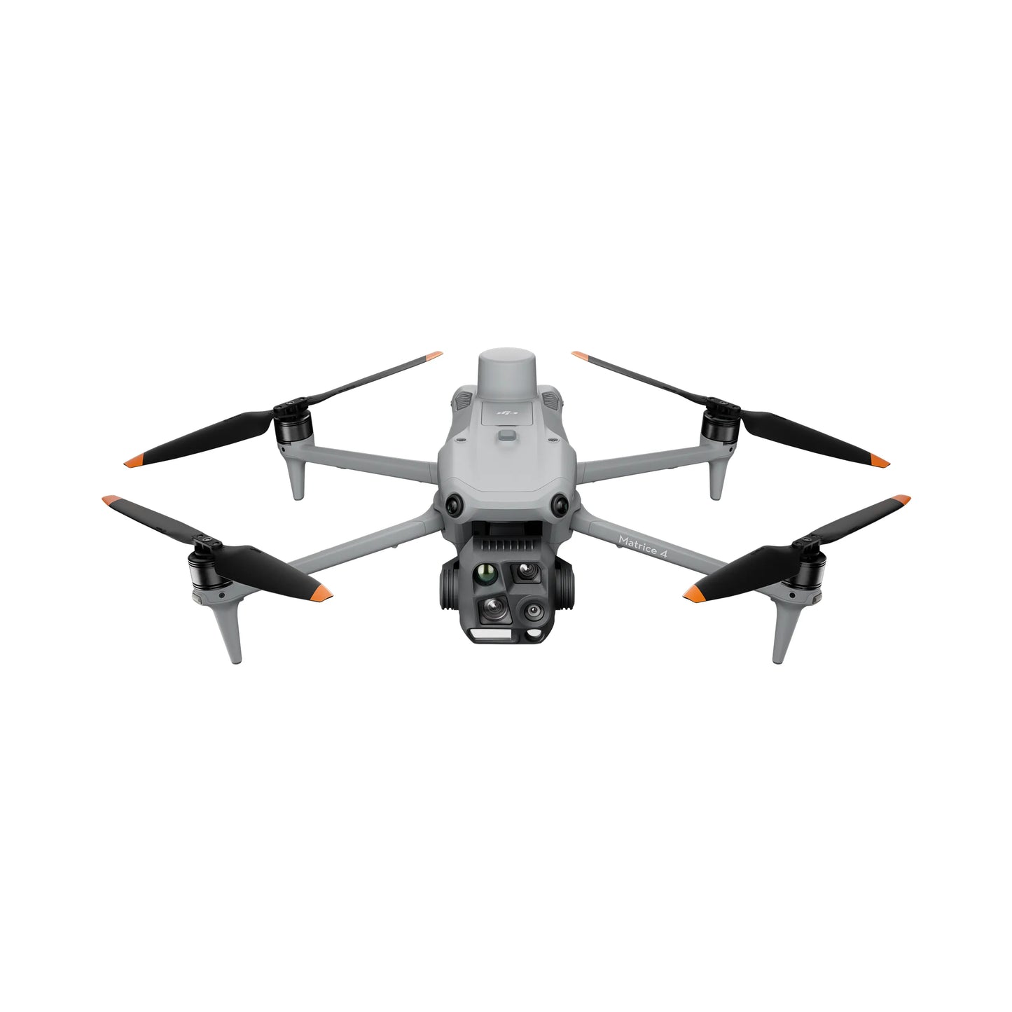
Introducing the DJI Matrice 4 Series, a new compact and intelligent multi-sensor flagship drone series for enterprise industries. The series includes Matrice 4T and Matrice 4E, each equipped with advanced features such as smart detection and measurement with laser range finder. Flight operations are now safer and more reliable with significantly enhanced sensing capabilities.
The accessories for the Matrice 4 series have also been significantly upgraded. The Matrice 4T is suitable for a wide range of industries, including electricity, emergency response, public safety, and forestry conservation. The Matrice 4E is designed for geospatial applications such as surveying and mapping, construction, and mining. A new era in intelligent aerial operations begins now.
Intelligent Operations
The built-in model can detect vehicles, vessels, and subjects during search and rescue operations or routine flights. It also supports switching to other models, enabling the expansion of application scenarios. Additionally, it supports high-res grid photos and features powerful tracking capabilities.
Laser Range Finder, Precise Measurement
The laser range finder enables real-time precise measurement. Through simple operations such as pin point, line drawing, and area calculation, it can complete tasks like marking target locations for inspection purposes or calculating the area of a wildfire. Additionally, users can share info via the DJI Pilot QR code or FlightHub 2 with relevant personnel to enhance collaboration and workflow efficiency.
Observation Range Recording
DJI Pilot 2 can highlight the center position of the camera frame and ground area observed. It can display the surveyed area on the map, making it especially useful for patrols, and rescue operations in mountainous terrain without clear landmarks.
Efficient Flight, Intelligent Operations
Cruise
Activate cruise control mode to pilot the drone in a specific direction without constantly pressing the control sticks, making long-distance flights easier.
FlyTo
In emergencies or disasters, the drone can automatically adjust its flight path and speed based on the surrounding environment, allowing it to reach a designated location without manual adjustments.
Smart Track
Smart Track allows for precise subject positioning and automatic zoom adjustments, allowing you to switch between subjects easily. It can automatically reacquire a subject even if obscured briefly.
POI
POI enables continuous observation and 3D modeling of buildings while flying around a designated area, greatly enhancing the efficiency of fixed-point observation and modeling tasks.
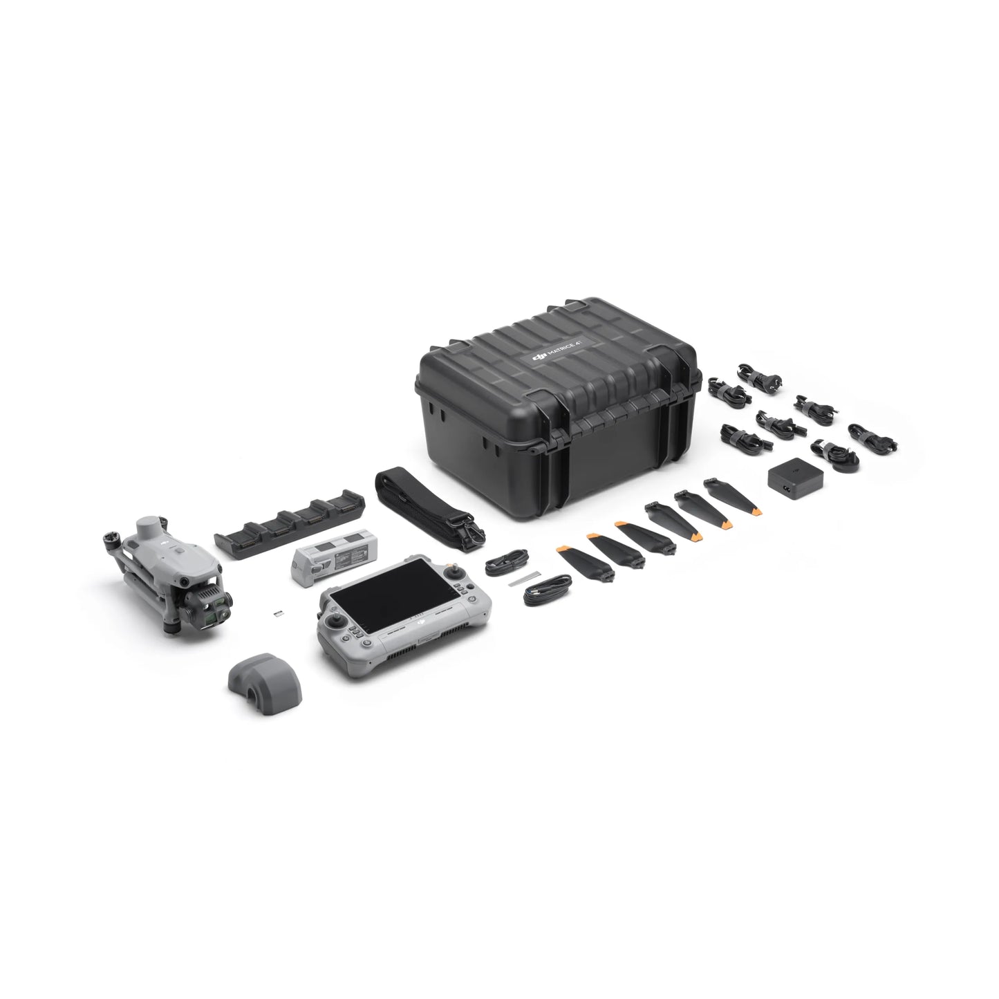
In the box
- 1 x DJI Matrice 4E
- 1 x DJI RC Plus 2 Enterprise
- 1 x DJI Matrice 4 Series Battery
- 1 x DJI Matrice 4 Series Charging Hub
- 1 x DJI 100W USB-C Power Adaptor
- 1 x microSD Card
- 1 x DJI Matrice 4E Gimbal Protector
- 1 x DJI Cellular Dongle 2 Pry Bar
- 3 x DJI Matrice 4 Series Propellers
- 1 x 100W Power Adaptor
- 1 x USB-C to USB-C Data Cable
- 1 x USB-A to USB-C Data Cable
- 1 x DJI Matrice 4 Series Storage Case
- 1 x DJI Matrice 4 Series Storage Case Shoulder Strap